• Lower Oxley Peak Hot Springs is an interesting geological phenomenon
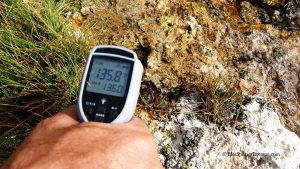
• Several hot springs on the hill side at a temperature from 140 to 150°F bubble up from the ground
On your way to Twelve Mile Hot Springs at the Bishop Creek, you can stop at Lower Oxley Peak Hot Springs. This spot is located 6 miles north of Wells and 4.3 miles before the turning point to 12 Miles Hot Springs.
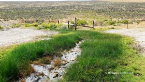
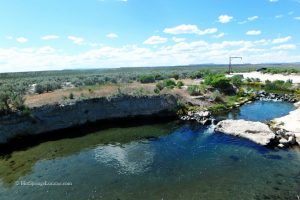
Lower Oxley Peak Hot Springs is an interesting geological phenomenon. Series of hot springs seep or bubble up from several sources on the hill side at a temperature from 140 to 150°F thus providing a mineral hot environment for thermophilic orange-green microbial mat (cyanobacteria) growth. The dense white ledges of salt deposits formed around the springs. The springs from the sources run out of the hill into a small stream giving the grass a chance to grow along the stream. The water is used by the ranch nearby. The hot springs have strong sulfur (“rotten egg”) odor.
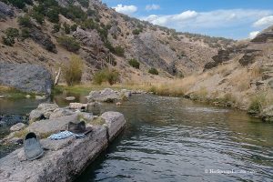
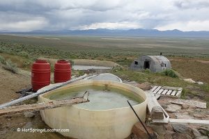
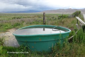
If you want to soak at Lower Oxley Peak Hot Springs, there are a pipe and bathtub you can fill to enjoy bathing and an excellent view from the northeastern Nevada hill.
The last 0.2 miles to the hot springs is a rough and bumpy dirt road. A high clearance 4WD vehicle is needed to drive uphill.
Camping & Lodging
Springs are located on the private property. Make sure to obey signs that have been posted here. There is no camping available at the hot springs. The nearest lodging is in Wells, 6 miles away.
Lower Oxley Peak Hot Springs | Facts
Location: 6 miles north of Wells • Northeastern Nevada • USA
Open: Year-round
Development: Undeveloped
Amenities: None
Hiking distance: From 0 to 0.2 miles
Road Access: A high-clearance 4WD vehicle is required for the final 0.2 miles when the weather is favorable
Day-use fees: None
Managed by: Springs are located on the private property; Make sure to obey signs that have been posted here.
Elevation: 5,800 ft (1,295 m)
Water T° (source): 140-150°F (60-66°C)
More Adventures
Directions to Lower Oxley Peak Hot Springs
From Wells in Nevada,
- On Highway I-80, take exit 351 toward W Wells, drive 0.7 miles on Humboldt Avenue to Sixth Street
- Turn right onto Sixth Street and continue 0.3 miles to Lake Avenue
- Turn left onto Lake Avenue and go 0.1 miles
- After crossing a railroad, turn left onto Eights Street
- Drive 5.3 miles Eights Street that becomes Metropolis Road and then Country Road 754 to a fork of three roads, take a left small dirt road uphill
- Drive 0.2 miles to the hot springs.
If you have a low clearance car or the last part of the road is impassable to drive, park your car on Country Road and hike for 0.2 miles.


