
Diana's Punchbowl is a boiling volcanic crater in remote Monitor Valley
Diana’s Punchbowl, also known as Devil’s Cauldron, is a volcanic crater filled with natural mineral water. It is located 72 miles southeast of the mountain town of Austin in the isolated Monitor Valley of central Nevada.
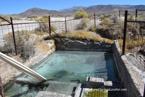
This remote geothermal site sits along a fault zone in Monitor Valley. The opening forms a large cavern about 50 feet wide, with vertical walls dropping roughly 30 feet.
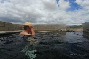
At the bottom, a dark blue-green pool of scalding water up to 190°F (88°C) releases steam, gases, and hot vapor.
Native Americans have known about this remarkable place for thousands of years. The name “Devil’s” reflects early beliefs that spirits and mysterious forces inhabited the site.
Early visitors also picnicked on the slopes of the surrounding travertine hills while enjoying the dramatic views.

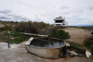
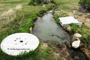
This geothermal area is better known for its dramatic natural landscape. However, smaller pools along the hot creek formed by overflow from Diana’s Punchbowl may offer opportunities for soaking.
As the water flows farther from the source, it cools to more comfortable bathing temperatures.
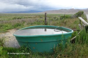
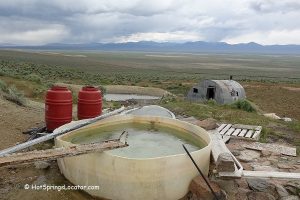
Several small dams have been built along the creek.

🔴 Warning: Use extreme caution near the crater edge and keep children at a safe distance. Dogs should be kept on a leash at all times.
Driving directly to the crater is not recommended for safety reasons. The opening may be difficult to see from a vehicle, especially at night or during rainy or foggy conditions.
Park near the cattle gate, close it behind you, and walk approximately 30 feet to the crater. The elevation gain is about 60 feet.

There are no restrooms, freshwater sources, or amenities on-site.
The nearest services are in Eureka, 68 miles away, and Austin, 72 miles away.
Please pack out all trash and follow Leave No Trace principles.

Places to Stay Near Diana's Punchbowl - Camping & Lodging
No posted restrictions for overnight camping. There are campgrounds operated by Forest Service such as Toquima Cave Campground, 17 miles away, and Pine Creek Campground, 21 miles away.
The closest accommodations can be found in Austin, 68 miles northwest and in Eureka, 69 miles northeast.
Affordable vacation rentals for short and long term stay in Austin
Affordable vacation rentals for short and long term stay in Eureka
Video
Diana's Punchbowl | Facts
Location: 46 miles southeast of Austin • Central Nevada • USA
Open: Year-round
Development: Undeveloped
Amenities: None
Distance from the parking: Short
Road Access: Any vehicle when the roads are dry
Day-use fees: Free
Elevation: 6,750 ft (2,057 m)
Water T° (source): 190°F (88°C)
Water T° (hot creek): Varies
More Adventures

Directions to Diana's Punchbowl
From Austin,
- Travel southeast on US-50 for about 12 miles to NV-376 S
- Turn right onto NV-376 S and after 0.3 miles turn left onto the first graded forest road NF-001
- Follow southeast on NF-001 for about 24 miles to Monitor Valley Road NV-82
- Turn right onto NV-82 and continue south 8.4 miles to a dirt road on the left
- Turn left (east) and travel 1.2 miles to the fence and cattle gate.