

Lee Hot Springs is a geothermal area, where scalding water flows from fractures in the Earth's crust
Located 19 miles from Fallon, Lee Hot Springs is a geothermal area hidden in the high Nevada desert and surrounded by rolling sagebrush-covered hills. Until the late 1990s, there was very little water at the springs, but later the thermal water flow increased significantly.
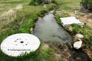
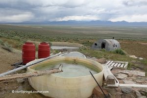
The hot springs, reaching temperatures of about 200°F (93°C), emerge from a fracture in the rocky ground.
Because the source water is extremely hot, it was fenced off to help prevent accidents. Warning signs are also posted.

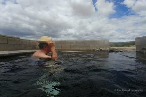
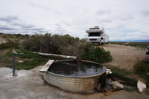
The scalding water is transferred from the source into a small pond. Once it reaches the pond, the temperature drops to around 105–110°F (41-43°C), depending on weather conditions.
At the time of our visit in September, soaking was impossible because the underground outflow was not large enough to fill the pond properly.
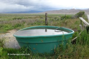
There are rusted, old bathtubs on-site, indicating that visitors once filled them with hot water and waited for it to cool.
The road to the hot springs from the highway is undeveloped and requires a high-clearance vehicle.
There is no developed campground at the hot springs.

Lee Hot Springs | Facts
Location: 28 miles south of Fallon • Central Nevada • USA
Open: Year-round
Development: Undeveloped, bathing opportunity is limited
Clothing: Optional
Amenities: None
Accommodations: Camping is not prohibited
Hiking distance: From 0 to 1.7 miles
Road Access: High-clearance 4WD vehicle is required for the final 1.7 miles when the road is okay
Day-use fees: None
Elevation: 4,000 ft (1,219 m)
Water T° (source): 200°F (93°C)
Water T° (creek): 105-110°F (41-43°C)


More Adventures


Directions to Lee Hot Springs
From Highway 50 in Fallon,
- Turn south onto Highway 95
- Travel 17.6 miles to the road to the dumping station on the left
- Turn left and go 0.1 miles to the dirt road on the right
- Turn right and follow 1.7 miles to the destination.
The road is not maintained, only high-clearance vehicles can make this trip.