• Sheep Creek Bridge Hot Springs is a wild hot spring at the Middle Fork Boise River
Sheep Creek Bridge Hot Springs is one of many geothermal spots in the scenic Boise National Forest.
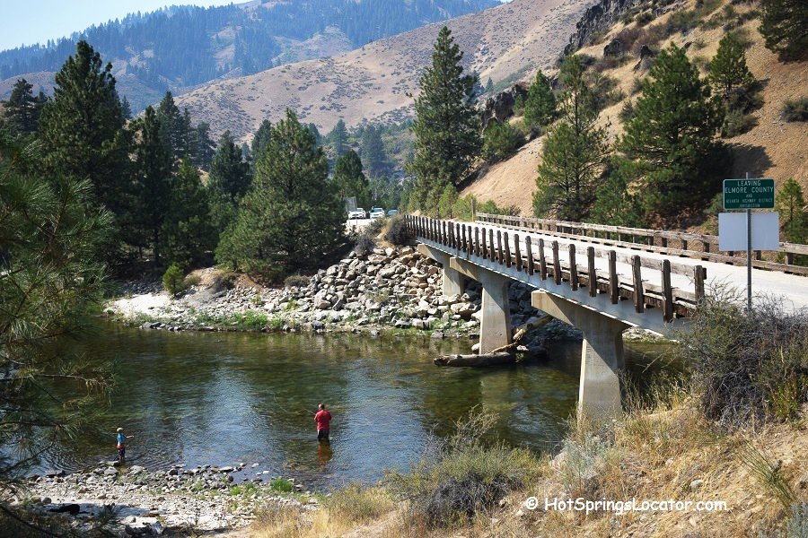
The spring is easy to find. It sits right at the bridge across the river, 50 miles northeast of Boise and 37 miles southeast of the old mining town of Atlanta.
You can park off the Sheep Creek Bridge and walk about 70 yards along a short trail to reach the source pool and then down to the river pools. No services are available here. Bathing suits are highly recommended, as the pools can be seen from the road.

Sheep Creek Bridge Hot Springs Experience
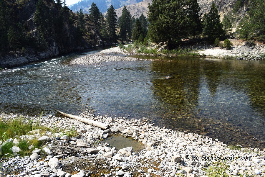
Hot mineral water emerges from the hillside at approximately 142°F (61°C) and cools as it flows down to the river. The source pool, covered with orange algae, sits above the river.
The shallow, primitive pools on the hillside and by the river are made from rocks and have sandy bottoms. Volunteers maintain the pools to the best of their ability. You can also help by maintaining or restoring the pools if you see that they need maintenance or restoration.
Because the water temperature can vary quite a bit, test the pool water before getting in. Some spots can be very hot.

Beyond Sheep Creek Bridge Hot Springs: Other Adventures
The Middle Fork Boise River is home to numerous wild hot springs and one developed site. Twin Springs Resort offers five rustic cabins, each with a private soaking tub.
Besides Sheep Creek Bridge, you can visit other nearby springs, Smith Cabin, Loftus, and Pete Creek Hot Springs.
Further upriver, near Atlanta, there are more hot springs, including Atlanta Hot Springs, Power Plant Recreation Area, and Chattanooga Hot Springs.
These pools are often located in rugged, scenic areas, allowing you to soak in the backcountry surrounded by forests and stunning river views.
The river is also great for fishing, with wild rainbow trout and mountain whitefish plentiful in its waters.
Hikers and nature lovers can enjoy the woods, wildlife, and peaceful riverbanks.

Camping and Lodging near Sheep Creek Bridge
Troutdale Campground is 2.5 miles away and operates on a first-come, first-served basis.
Twin Springs Resort is a rustic hot springs resort located 4 miles west of the Sheep Creek Bridge. It offers river-side cabin lodging and individual hot tubs at each cabin.
If you prefer more comfortable lodging, consider lodging in Idaho City.

Sheep Creek Bridge Hot Springs | Facts
Location: 49 miles east of Boise • Idaho • USA
Best time: Late spring through fall
Development: Wild
Clothing: Recommended
Amenities: None
Hiking distance: Short
Road access: A high clearance vehicle is recommended
Day-use fees: None
Elevation: 3,400 ft (1,036 m)
Water T° (source): 142°F (61°C)
Water T° (pools): Varies
Odor: None
More Adventures
Directions to Sheep Creek Bridge Hot Springs
From Boise,
- Travel east on Highway 21 to Mores Creek Bridge
- Cross the bridge and turn right onto Spring Shores Road/Middle Fork Boise River Road toward Atlanta
- Continue 30 miles on Middle Fork Boise River Road to the east side of the bridge.
Park your car at the bridge, find a trail, and walk about 70 yards downstream to the pools.


