

• Alkali Lake Hot Springs is one of the numerous hot springs within Long Valley Caldera
Alkali Lake Hot Springs is one of the numerous hot springs of Long Valley Caldera, located near Warm and Big Alkali Lakes.
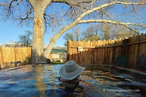
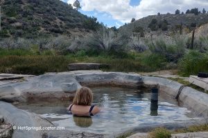
Alkali Lake Hot Springs Soaking Experience
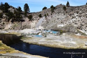
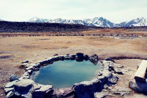
The hot mineral water gushes out of the Earth’s crust at a temperature of 135°F (57°C), a hundred yards away from Warm Lake and a parking area. A large corrugated metal pipe covers the source.
The hot water is transferred through a plastic pipe into a shallow concrete tub 50 feet away. The water cools down a little, but it can still be too hot to bathe. If it is too hot, water could be diverted and cooled.
Currently, these hot springs do not provide the best soaking experience, but they are located near a highway and are available year-round.

Alkali Lake Hot Springs Camping & Lodging
Camping isn’t allowed right by the springs, but dispersed camping is permitted on nearby BLM land. Alternatively, you can stay at Brown’s Owens River Campground, about 2.5 miles away. Dispersed camping is primitive, with no facilities, so bring your own supplies and pack out all trash.
The nearest lodging is in Mammoth Lakes, about 16 miles west.
Affordable vacation rentals for short and long-term stays at Mammoth Lakes


Alkali Lake Hot Springs | Facts
Location: 13 miles east of Mammoth Lakes • California • USA
Best time: Year-round
Development: Primitive
Clothing: Optional
Amenities: None
Hiking distance: Short
Road Access: Any vehicle
Day-use fees: None
Managed by: Bureau of Land Management (BLM)
Elevation: 6,800 ft (2,073 m)
Water T° (source): 135°F (57°C)
Water T° (pool): 115-130°F (46-54°C)
More Adventures


Directions to Alkali Lake Hot Springs
From Highway 395,
- Turn north to Benton Crossing Road
- Drive 4.4 miles to the small dirt road and gate near the lake.