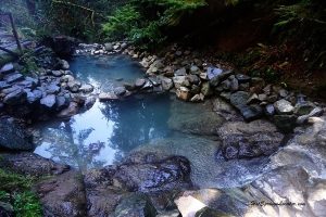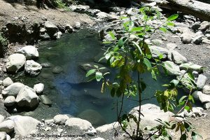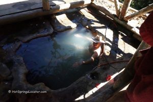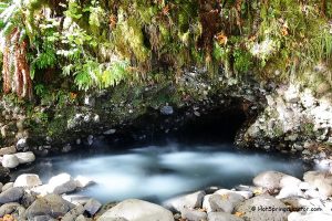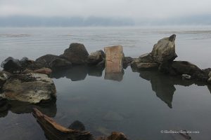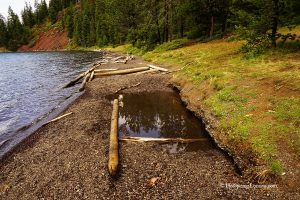
• McCredie Hot Springs emerge on both banks of Salt Creek
McCredie Hot Springs is located along Salt Creek, near Oregon Route Highway 58, approximately one hour away from Eugene. This natural hot spring is known for its easy access and extremely hot water.
In the past, McCredie Hot Springs was home to a popular resort, which later became a disreputable brothel. In 1958, the hotel burned down, and in 1964, a flood destroyed the bridge and swimming pool.
The hot springs were named after Judge Walter McCredie, a former baseball player and the third owner of the site. In 1914, he built a two-story resort hotel. Though the hot springs have changed ownership multiple times, the name McCredie remains in use.
Today, McCredie Hot Springs is an undeveloped site on U.S. Forest Service land, open from sunrise to sunset.

McCredie Hot Springs Experience
Hot spring water emerges on both banks of Salt Creek.
North Bank: Scalding 160°F water flows from a concrete block into pools made of rock and mud, built by visitors. As the water moves through the pools, temperatures drop, but can still range from 100°F to 160°F. If you don’t want your soaking to be translated into scalds, test the water temperatures first before diving or stepping into the pools. If necessary, mix in cooler river water.
The parking area is large and well-paved, making access convenient.

South Bank: The south hot springs are across Salt Creek. However, crossing the creek is unsafe, especially during high water or spring runoff.
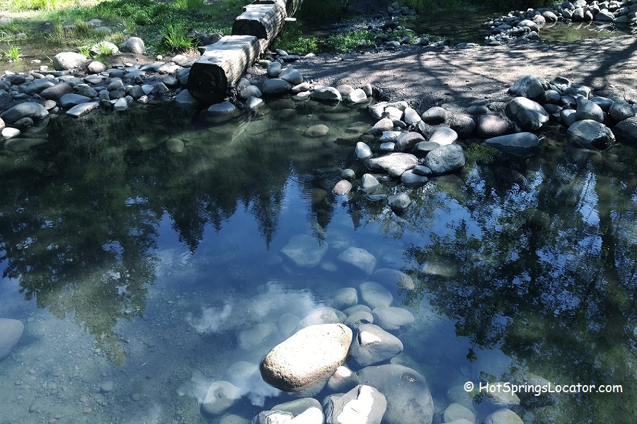
On the south bank, you’ll find a rock wall, a remnant of the old resort, alongside a few shallow pools. Mineral water emerges at 125°F from the base of the wall, but the pools cool to a more comfortable 100°F to 105°F, making them generally warmer than those on the north bank.
The largest pool is about 13 feet across and 2 feet deep, while the smallest is about 3 feet across. The bottom consists of organic material and mud, but be cautious—rocks and broken glass may be present due to past visitors.

Beyond the Hot Springs: Other Adventures
McCredie Hot Springs is a fantastic spot. But did you know there's so much more to explore nearby? Here are a few adventures you shouldn't miss:
Salmon Creek Falls - A beautiful waterfall that's easy to reach and fun to explore. The water rushes down rocks and sprays mist into the air. It's a great spot to cool off on a hot day. Bring your camera, because you'll definitely want pictures!
Salt Creek Falls - This waterfall is even bigger and more impressive. Actually, it's one of Oregon's tallest falls! When I stood near the viewpoint, I felt tiny looking at all that rushing water.
Odell Lake - If you like water activities, Odell Lake is your spot. You can swim, fish, kayak, or just relax by the shore.
And if you're still craving more soakings in the geothermal water, swing by the Wall Creek Warm Springs. It's smaller and quieter than McCredie.
McCredie Hot Springs: Camping, Lodging & Vacation Rentals
The Blue Pool Campground, located just 0.5 miles west along Salt Creek, is a seasonal, non-electric campground ideal for tent camping. The site offers picnic tables, vault toilets, and access to drinking water. Reservations can be made through recreation.gov to secure a campsite.
For those seeking additional accommodations, Oakridge, located 10 miles west, offers lodging, dining, and essential services. Alternatively, Eugene, located 50 miles east, provides a broader range of hotels, restaurants, and shopping options.
Affordable vacation rentals for short and long term stay at Oakridge
Affordable vacation rentals for short and long term stay at Eugene
Video
McCredie Hot Springs | Facts
Location: 10 miles east of Oakridge • Cascade Mountains • USA
Open: Year-round from sunrise to sunset
Development: Undeveloped
Clothing: Optional
Amenities: Vault toilet, picnic tables
Hiking distance: Northside: 0.1 miles; south side: 0.3 miles
Road access: Any vehicle
Day-use: Free
Managed by: US Forest Service
Elevation: 2,064 ft (629 m)
Water T°: 100°F (38°C) to 163°F(73°C)
Water acidity level: Neutral (pH=7.4)
Springs Type: Sodium and calcium chloride
Average dissolved solids: 2,650 ppm
Flow rate: 75 l/min
Chemical used: None
| Cations Sodium (Na) - 910 Mg/L Calcium (Ca) - 500 Mg/L Potassium (K) - 28 Mg/L Boron (B) - 17.8 Mg/L | Anions Chloride (Cl) - 2,232 Mg/L Sulfate (SO4) - 190 Mg/L Silica (SiO2) - 65.4 Mg/L Bromine (Br) - 33 Mg/L Carbonate (CO3) - 20 Mg/L Fluoride (F) - 2.68 Mg/L |
More Adventures
Directions to McCredie Hot Springs
Northside
- From I-5, take exit 188 in Eugene for OR-58
- Drive for about 46 miles to McCredie Hot Springs on the right.
The north side of the McCredie Hot Springs is located between mileposts 45 and 46.
GPS (North side): N 43°42.426' W 122°17.394' | 43.7071, -122.2899
Southside
- Drive 0.5 miles southeast from the parking area at the north side of McCredie to Shady Gap Road
- Turn right onto Shady Gap Road
- Cross the bridge and then turn right onto NF-5875
- Proceed 0.1 miles to a trailhead on the right.
The hot springs are located approximately 10 minutes away from the trailhead. An easy 0.3-mile trail runs downstream along Salt Creek.
GPS (South side): N 43°42.056' W 122°17.094' | 43.7009, -122.2849

