• South Harney Lake Hot Springs is located in the remote caldera depression
• The second hottest geothermal source in the Harney Basin
South Harney Lake Hot Springs is Closed to Public
South Harney Lake Hot Springs is located inside of the Harney Basin - a caldera depression that has been created 32,000 years ago when huge lava flows separated the basin from the Malheur River.
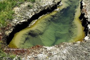
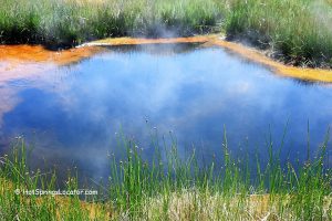
Found at the southeastern edge of Harney Lake, South Harney Lake Hot Springs is a collection of bubbling hot springs with a distinct sulfur smell. The temperature of the geothermal sources is over 150 degrees F. The mineral water cools down, flowing from the colorful, hot pond through the flat sagebrush landscape into the narrow channel. According to GTILO, South Harney Lake Hot Springs is the second hottest geothermal resource in the Harney Basin. The flow of the springs is greater than 450 liters per minute.
A plastic tub or container is one of the options for taking a soak. You can fill it with hot water from the channel. The water downstream of the pools is cleaner and hot enough at about 100-110°F to take a bath. Overall, this hot springs doesn't provide the cleanest or safest soaking experience due to its very high temperatures, muddy interior, and possible red spider mites.
It is not recommended to travel to the hot springs until mid-summer. During the winter and spring seasons, the last 8.5 miles of unimproved roads will likely be snowy or incredibly muddy.
Though the hot springs are located on private land, they're available for public use. No signs indicate if overnight camping is prohibited here, but we suggest looking for BLM camping options.
If you ever visit this area, please do not abuse the privilege of accessing the area. Be sure to leave no trace behind!
Video
South Harney Lake Hot Springs | Facts
Privately owned and closed to public
Location: 34 miles south of Burns • Eastern Oregon • U.S.
Elevation: 4,100 ft (1,250 m)
Water T° (source): 140-150°F (60-65°C)
Water acidity level: Neutral (pH=7.26)
Springs type: Sodium Bicarbonate Chloride
Flow rate: 119 gallon/min (450 l/min)
Chemical used: None
Average dissolved solids: 2,100 ppm
| Cations Sodium (Na) - 630 Mg/L Potassium (K) - 13 Mg/L Calcium (Ca) - 12 Mg/L Magnesium (Mg) - 1.8 Mg/L | Anions Chloride (Cl) - 590 Mg/L Carbonate (CO3) - 568 Mg/L Sulfate (SO4) - 140 Mg/L Silica (SiO2) - 92 Mg/L Fluoride (F) - 3.3 Mg/L Boron (B) - 11.3 Mg/L |
More Adventures
"Geothermal Information Layer for Oregon". www.oregongeology.org


